
Story highlights
Maysak has sustained winds of more than 130 mph but is expected to weaken
It's forecast to hit the Philippines during the Easter weekend
A large storm system dubbed Typhoon Maysak is churning over the Pacific Ocean, days away from a possible direct hit on the Philippines.
Maysak is moving west-northwest after skirting the Federated States of Micronesia, according to the U.S. Joint Typhoon Warning Center. Its eye is projected to make landfall in the central or northern part of the Philippine island of Luzon on Sunday, though the country’s residents could start feeling its effects days before.
That could interrupt the Easter celebration for many in the predominantly Catholic nation, which may be socked by heavy rains and potent winds. The International Red Cross noted that “many people are expected to throng coastal areas at this time.”
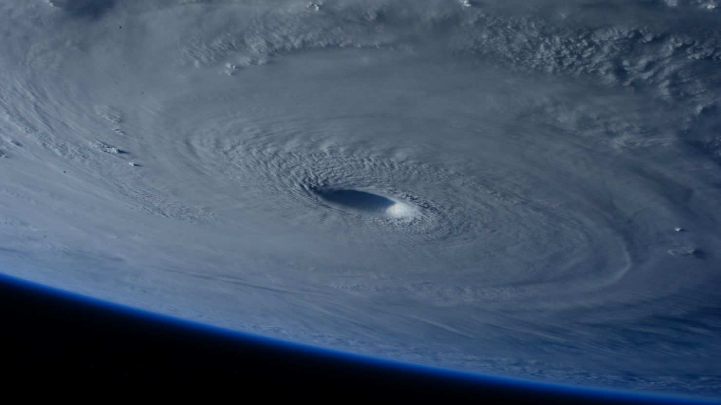
Images of the typhoon as seen from the International Space Station were posted to Twitter, including a Vine video showing the swirling eye of the storm.
The storm has weakened and is expected to lose more strength before it reaches the Philippines. Its maximum sustained winds on Wednesday were 150 mph, making it a super typhoon in the Joint Typhoon Warning Center’s definition.
But by Thursday, the winds’ strength had declined to around 132 mph – no longer a super typhoon but still the equivalent of a Category 4 hurricane.
Meteorologist Ivan Cabrera told CNN that Maysak could weaken further to become a tropical storm by the time it reaches the Philippine coast.
“This will not be a catastrophic storm,” Cabrera said. That said, it could still cause flooding and bring strong winds, he cautioned.
The Philippines is frequently hit by typhoons. In December, for instance, Hagupit killed at least 18 people in the East Asian nation and injured hundreds more.
But that devastation paled in comparison to the havoc wrought by Super Typhoon Haiyan in November 2013, which killed more than 6,000 people and injured more than 27,000 others. That typhoon, considered to be among the strongest storms ever to make landfall, hit the eastern city of Tacloban especially hard.
The irony of the upcoming storm is its timing: in April, just after the Philippines Atmospheric Geophysical and Astronomical Services Administration officially declared the onset of the nation’s dry, or summer, season.
PAGASA meteorologist Shelley Ignacio predicts Maysak – which is called Chedeng in the Philippines – will bring heavy rains to Luzon starting on Friday, according to the state-run Philippines News Agency.
The country’s National Disaster Risk Reduction and Management Council went on red alert on Wednesday because of the storm, the news agency reports. That alert means all relevant personnel are on standby and the public should be on guard for possible effects of the storm.
CNN’s Jethro Mullen contributed to this report.