Story highlights
NEW: Chantal has degenerated into a tropical wave
NEW: Jamaica and Cuba could see rains, winds
Some spots could get as much as 6 inches of rain
Chantal now has top sustained winds of 45 mph
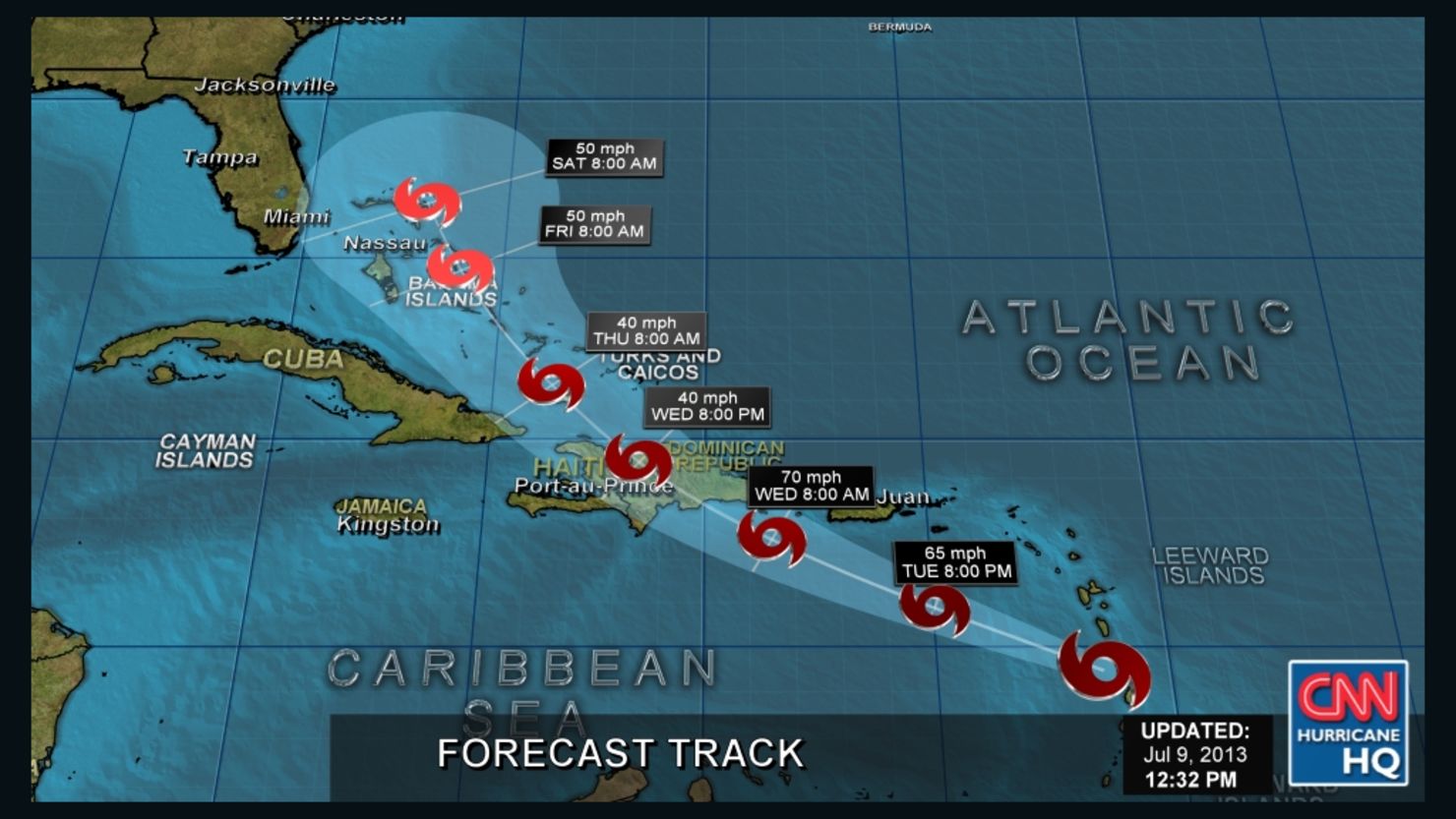
The remnants of Chantal aren’t much to look at, but they still threaten to bring heavy rains and fierce wind gusts to Jamaica and Cuba.
Chantal, which dissipated into a tropical wave on Wednesday, is moving through the Caribbean at 23 mph. The remnants of Chantal are expected to spread over Jamaica and eastern Cuba Wednesday night, and could be near Florida by Friday, the National Hurricane Center said.
The tropical wave was about 230 miles (370 kilometers) east-southeast of Kingston, Jamaica, on Wednesday evening.
Chantal had been packing 65 mph winds earlier in the week, but the storm’s top sustained winds slipped to 45 mph early Wednesday, according to forecasters.
Even as it weakens, tropical storm force winds from Chantal could still affect Haiti and eastern Cuba into Thursday, the center said.
Remnants of Chantal are expected to produce 3-6 inches of rainfall in Hispaniola, Jamaica, parts of Cuba and the southeastern Bahamas.